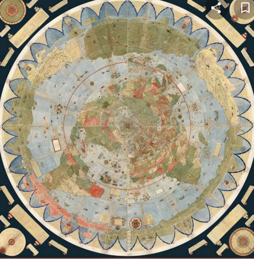
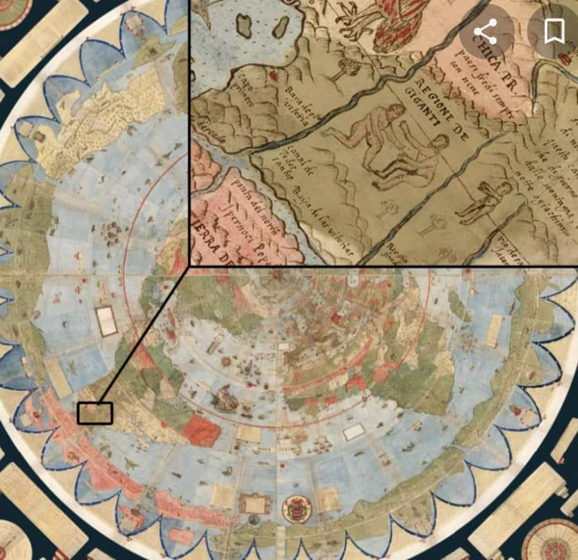
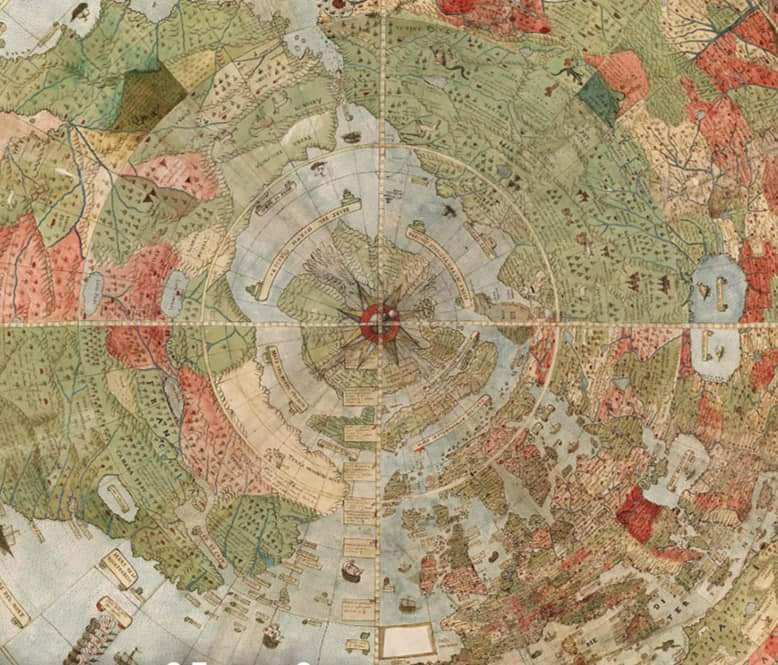
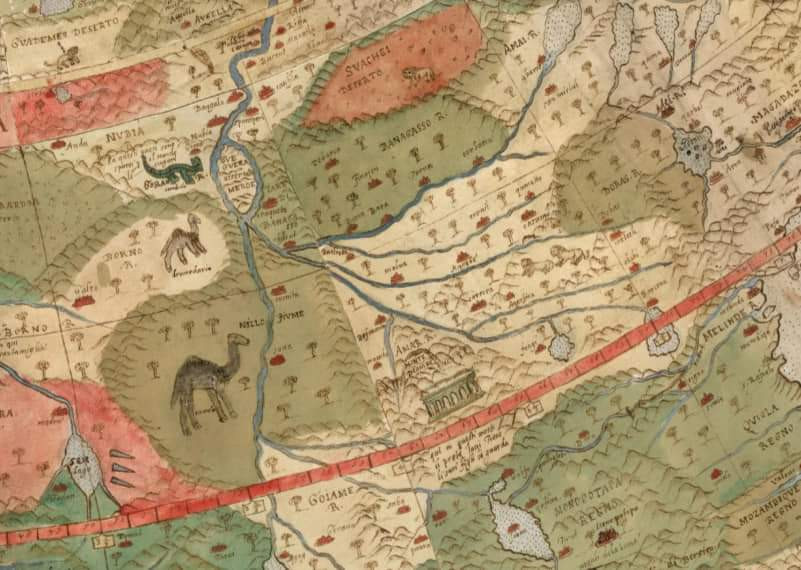
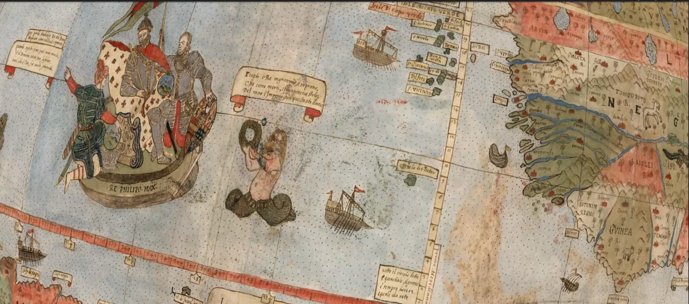
Monte Urbano map from 1587. Notice there's no ice wall, instead, we see cities & towns. Also shows regions where giants lived.
David Rumsey Historical Map Collection | Largest Early World Map - Monte's 10 ft. Planisphere of 1587
An extraordinary 60 sheet manuscript world map made in 1587 by Urbano Monte has been added to the David Rumsey Map Collection at Stanford University. At 10 f...
https://www.davidrumsey.com/blog/2017/11/26/largest-early-world-map-monte-s-10-ft-planisphere-of-1587Q follower Arizona #KAG Patriot who loves God and Country #MAGA Trump/JFKJr 2020 #SaveTheChildren Evil Won't Survive in 5D
Is that a merman???
Check out this link to the Rumsey site. You can spin the earth by touching it, but it only spins to the left and it will open up automatically to a close-up view.
https://www.davidrumsey.com/luna/servlet/workspace/handleMediaPlayer?qvq=q%253Apub_list_no%253D%252210130.000%2522%253Bsort%253APub_List_No_InitialSort%252CPub_Date%252CPub_List_No%252CSeries_No%253Blc%253ARUMSEY%257E8%257E1&trs=94&mi=93&lunaMediaId=RUMSEY~8~1~303668~90074325
no idea this map is way out there
Q follower Arizona #KAG Patriot who loves God and Country #MAGA Trump/JFKJr 2020 #SaveTheChildren Evil Won't Survive in 5D
It is pretty amazing and probably an actual map imo. There appear to be many more continents and earth is much larger.
maybe if you translate the text it explains what it is.......maybe its a Poseidon
yup mermaid
Above all, Monte's was an ocean-oriented map. Ships of all description can be found criss-crossing his oceans. King Philip II of Spain himself — who, in his rule as Duke of Milan, was Monte's liege lord — makes an appearance on a ship of state off the coast of Brazil. He is offered a wreath by a mermaid ("here you are, magnanimous and sovereign King," reads a caption). King Philip holds a sphere of the world, mimicking the circular shape of the map itself. And at his side appears Atahualpa, the Inca Emperor, who offers a container of gold and a sphere labelled "Peru." In an accompanying caption, Atahualpa says, "When subject to me and to Satan, the New World was unhappy. Now that it is your's, it is more happy."

