ONLY ON ANONUP AND TWITTER. I AM NOT ON TELEGRAM OR ANYWHERE ELSE.
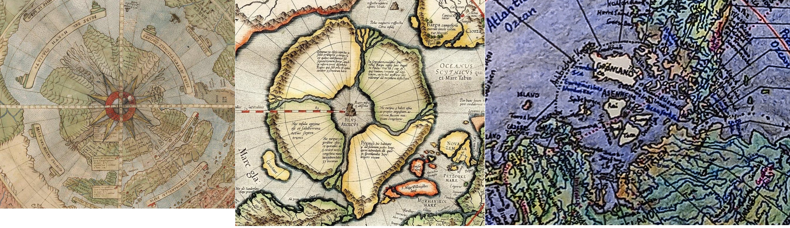
Here's 3 different maps depicting similar North Pole aka Arctic. As some are focused on Antarctica, I believe that it is also very important to learn what is hidden on Arctic too.
Maps:
A. Urbano Monte map from 16th century
B. 1606 Mercator Hondius Map of the Arctic
C. Map that VK shared
1/2
What lies in the center on some maps is called Hyperborea (pic#2).


Saw a great video a couple years back about the North Pole. It gave historical accounts of 4 rivers draining into a large opening. Out of the opening came a neon green glow and vikings said it had a strong pull, so don't sil close to it or your would get sucked in...magnetic force I think it said. I have since searched for the video but can't find it 😕